Choosing Between Aerial Property Inspections and Scattered Inspection Photos
Why inspection data matters for property managers
Property managers and facility teams rely on accurate visual records to track building conditions, plan maintenance, and document changes over time. Traditional inspection methods often produce a collection of photos taken from ground level or from a lift, each one showing a different angle, at a different time of day, under different lighting. The result is a scattered set of images that can be hard to compare side by side. Aerial property inspections, by contrast, offer a consistent, comprehensive view that captures every part of a structure in a single flight. The choice between these two approaches affects how efficiently you can identify issues, share findings with stakeholders, and build a long-term record of property condition.
What scattered inspection photos typically look like
When a property manager needs to check a roof, a facade, or a large facility, the usual approach is to send someone on site with a camera. The inspector takes dozens or even hundreds of photos, each framed differently, from various distances, and often in inconsistent lighting. These images are then saved in a folder or uploaded to a shared drive. The file names may include the date or a rough location, but there is no standard way to organise them. Over time, the collection grows, and finding a specific area or comparing two inspection dates becomes a tedious task.
Scattered photos also make it difficult to see the big picture. A close-up shot of a cracked tile tells you nothing about how the crack relates to the rest of the roof. A wide-angle shot from a ladder might show part of the gutter but not the entire drainage path. Property managers end up spending more time hunting for the right image than they do analysing what the image shows. And when it comes time to share evidence with a contractor or an insurance adjuster, the lack of a clear, organised record can lead to misunderstandings or delays.
How aerial property inspections change the picture
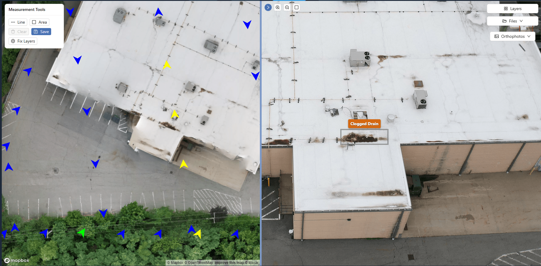
Aerial inspections, typically conducted with a drone, capture every surface of a building in a systematic way. A single flight can produce hundreds of overlapping images that are later stitched into a continuous site map or a 360 panorama. The result is a complete visual record that shows the entire structure in context. Instead of flipping through individual photos, you can zoom in on any area of the map, compare the same spot across different inspection dates, and measure distances or areas directly on the image.
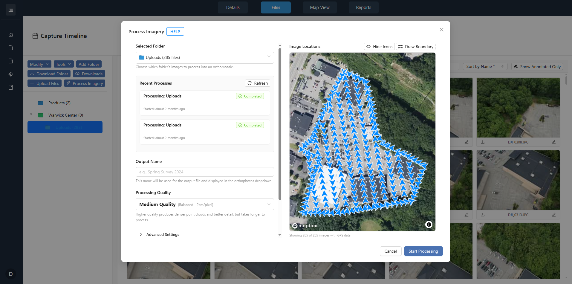
This approach is especially valuable for roof inspections. A roof is often the most vulnerable part of a building, and access is usually limited. A drone can fly over the entire roof surface, capturing every tile, membrane, and flashing detail without putting anyone at risk. The images are aligned and georeferenced, so you can pinpoint the exact location of a maintenance issue and track how it changes over time. For property managers overseeing multiple buildings, this consistency means each property has a comparable baseline, making it easier to prioritise repairs and allocate budget.
The role of a drone imagery archive
Neither scattered photos nor raw aerial footage is useful on its own. What makes aerial inspections powerful is the ability to store, organise, and retrieve the imagery through a drone imagery archive. This is where a platform like DataDelivery comes into play. It provides a structured way to process, organise, view, compare, and deliver aerial imagery and mapping outputs through client portals. Instead of emailing large files or sharing a link to a disorganised folder, property managers can access a central repository where every inspection is tagged by date, property, and area of interest.
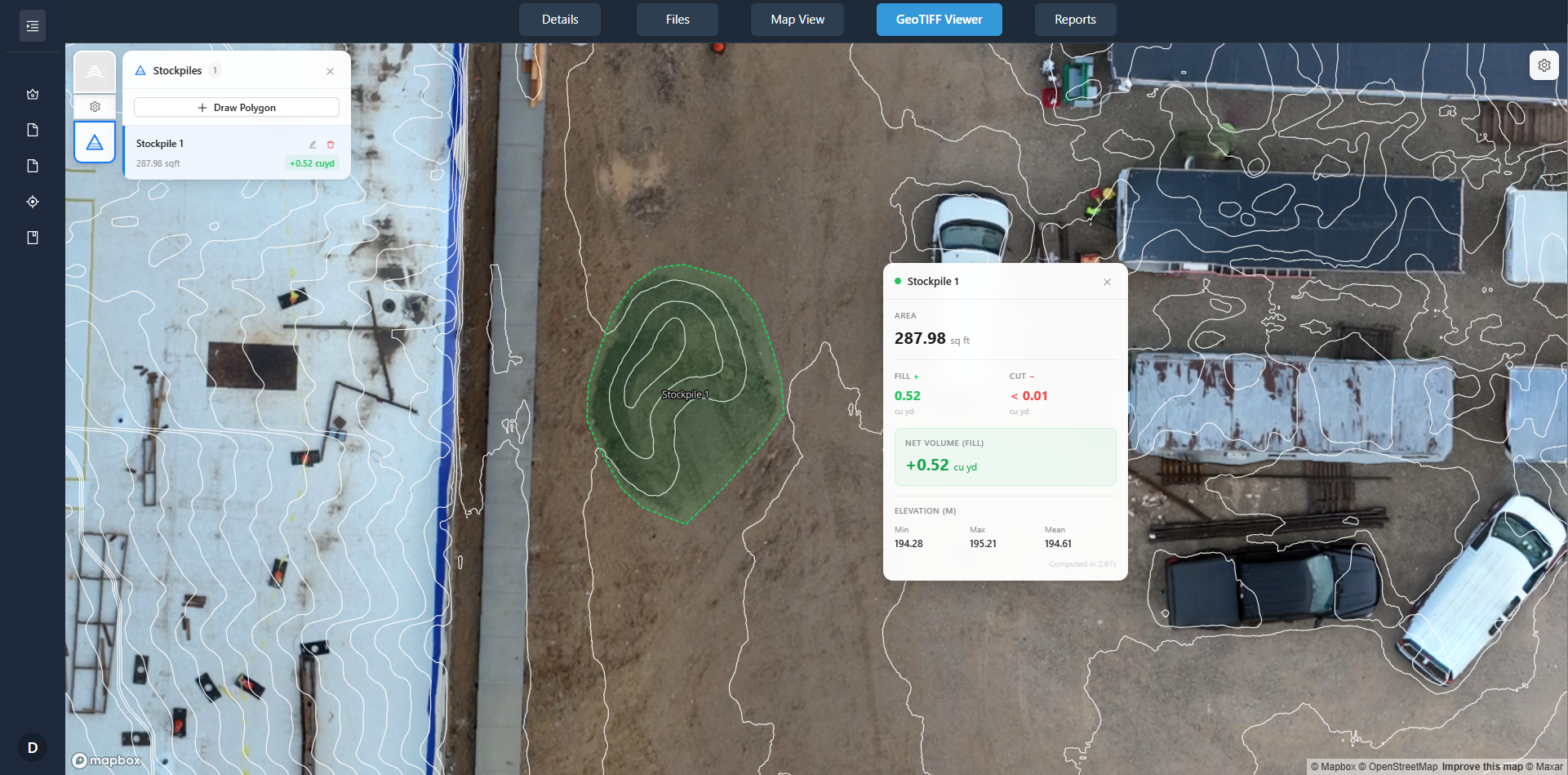
A drone imagery archive also supports side-by-side comparison. You can overlay a current inspection with one from six months ago and see exactly where a crack has widened or where ponding water has left a stain. This ability to track change over time turns raw image data into actionable intelligence. For facility condition assessments, it means you can document the progression of wear and tear, support warranty claims, and prove that maintenance was performed on schedule.
When scattered photos still make sense
Scattered inspection photos are not always the wrong choice. For small properties or single-family homes, the effort of setting up a full aerial inspection may be more than the situation requires. If you only need a quick visual of a gutter or a chimney, a couple of ground-level shots taken with a phone might be enough. Similarly, for interior inspections, where aerial coverage is not possible, traditional photos remain the standard.
Scattered photos can also be useful as supplementary evidence. A close-up of a specific defect, taken from the best angle, can highlight a detail that a wider aerial image might miss. The key is not to rely on scattered photos as your primary record for large or complex properties. The trade-off is speed versus completeness: a few photos are faster to capture, but they leave gaps in the record that can cause problems later.
When aerial inspections are the better fit
Aerial inspections excel in situations where consistency and coverage matter most. For commercial properties, multi-building campuses, or industrial facilities, the ability to capture the entire site in one organised dataset saves time and reduces the risk of missing something. Roof inspections are an obvious use case, but aerial imagery also helps with facade assessments, parking lot condition surveys, and perimeter security checks.
Property managers who handle multiple properties across different locations benefit from a standardised inspection process. With aerial inspections, each site is documented in the same format, at the same resolution, and with the same level of detail. This uniformity makes it straightforward to compare conditions across properties and to spot trends that might otherwise go unnoticed. For example, if several roofs in a portfolio show similar wear patterns, you can schedule proactive maintenance before a small issue turns into a costly repair.
National Drone Services offers an example of how aerial inspections can be integrated into a property management workflow. By providing organised, date-stamped imagery through a central platform, the approach eliminates the chaos of scattered photo folders and gives property managers a reliable visual record they can trust.
Building a long-term visual record
The real value of aerial inspections becomes apparent over time. A single inspection gives you a snapshot of condition on one day. A series of inspections, all captured in the same way and stored in a drone imagery archive, gives you a timeline. You can watch how a flat roof accumulates standing water after each rain event, how a facade weathers over the seasons, or how vegetation encroachment affects a building envelope.
This long-term record is invaluable for budgeting and planning. Instead of reacting to emergencies, property managers can use historical imagery to predict when a roof will need replacement or when a parking lot will need resurfacing. The data also supports insurance negotiations. If a storm damages a building, you have a clear before-and-after record that shows the pre-existing condition versus the new damage. That kind of evidence can speed up claims and reduce disputes.
Making the choice
There is no one-size-fits-all answer. For a quick check on a small, simple structure, scattered photos may be enough. For anything larger, or for any property where you need to track changes over time, aerial inspections supported by a drone imagery archive offer a clear advantage. The decision comes down to the scale of the property, the level of detail required, and the importance of having a consistent, searchable record.
Property managers who invest in a systematic approach to inspection imagery save time, reduce risk, and gain a deeper understanding of their assets. National Drone Services is one example of how this approach can be put into practice, but the principle applies broadly: organised, date-stamped aerial imagery beats a folder full of random photos every time.